
6.2 magnitude quake hits Papua New Guinea coast
Earthquake of 6.2 magnitude strikes off the coast of Papua New Guinea
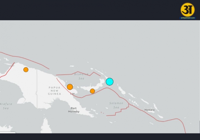
On Saturday, a 6.2-magnitude earthquake struck off the coast of Papua New Guinea's New Ireland province. The earthquake occurred at a depth of 72 kilometers (44 miles) and was about 115 kilometers southeast of Kokopo, a town in the region.
The United States Geological Survey (USGS) confirmed the earthquake, but fortunately, there were no reports of serious damage in the area. Emonck Abelis, a receptionist at Kokopo Beach Bungalow Resort, mentioned that the earthquake lasted for about a minute. Despite the shaking, there was no visible damage in the area, and people did not appear to be harmed.
Frequent earthquakes in the region
Papua New Guinea is part of the "Ring of Fire," a region known for its high levels of seismic activity, including frequent earthquakes and volcanic eruptions. The Ring of Fire stretches across Southeast Asia and the Pacific Ocean, and the countries within this region often experience tremors and other natural disasters due to the movement of tectonic plates.
While earthquakes are common in this area, they usually don’t cause widespread destruction, especially in sparsely populated regions. However, even minor earthquakes can trigger dangerous landslides, which can be harmful to people living in affected areas. Authorities often remain on alert for such secondary hazards, which can sometimes cause more damage than the initial earthquake itself.
Overall, the earthquake in Papua New Guinea did not lead to significant harm, but the region remains on high alert for future seismic activity.
ALSO READ: Hudson River helicopter crash: Aircraft was low on fuel, planned landing in 3 minutes
ALSO READ: Death toll nears 184 after nightclub roof collapse in Dominican Republic